Inflatable Canoeing Adventures - Buy this eBook!

Most of us can relate to the fun we had canoeing at summer camp when we were young. But that was nothing compared to the experience of whitewater kayaking that came next for me. I have always loved canoeing, though it always seemed difficult to participate. It has only been in the last decade that the development of inflatable canoes has made a big difference. You can more easily access rivers, you can store a canoe in your car, you can even take them on a plane. They are very light, very cheap, with little loss of functionality. Perfect for weekends away or campervan holidays. Social networking was the other big change. You can now use Facebook, etc to join canoeing adventures in your local region or abroad.

Inflatable Canoeing Adventures - view the table of contents! Click here to download the table of contents for this eBook, available for just $US7.95.
Showing posts with label Canoeing Trips. Show all posts

Tuesday, July 21, 2009

Kayaking the Chico River

Last week we visited the area of Sagada, which hosts some of the Philippines best limestone caves. Actually I did not visit the caves, as I was quite sure they would not be as spectacular as Jenolan Caves, west of Sydney. Anyway, 10km south of Sagada is the town of Sabangan, which lies on the Chico River. The Chico River would have to be one of the better rivers in the Philippines for kayaking. The river has a continuous series of rapidsore interested in the canoeing, so for those who are similarly interested, I am planning a return to the area in May 2010 to kayak this river. The rapids are mostly grade 2-3. I hear there are grade 4-5 rapids, though based on my river observation from the main road, this is more likely the lower section. I only saw the river as far as east as the Sagada turn-off, and it was not suited to rafting (i.e. too narrow, too shallow). The Chico River flows from Mountain Province, a few hundred kilometres north of Manila, but it takes 6 hours alone to drive the 80km section from Baguio-Sagada because although the road is mostly sealed, its VERY windy. Fortunately there were no tricycles in this section.

I would also be worthwhile to take some time to walk along the river from Panorama ParkView to the town of Sabangan. I have no doubt that you should be able to get a tricycle back to your car if you leave your car there, otherwise its a steep walk back to the car. There appears to be a steep alternative exit further back (round trip). I did not do it on this walk, but I would like to return to the area to kayak the river and to walk along the Chico River. The pathway passes along the river through rice terraces.
Increasingly I see that the Dept of Tourism in the Philippines is starting to spend money on worthwhile project as these to boost tourism, and to give visitors something to do. If you are more interested in rafting, there are groups that run rafting trips on the river. I have information on this, or you can inquire at the Rock Inn, in Sagada. This is a fairly nice place to stay. Nice accommodation, though off-season you will have to wait a few hours for a meal as they do down to the markets to buy the food.
If you want to get to this area, I would advice coming in from the Nueva Viscaya province (east side). The road is not as good, but it will be faster, particularly as they are currently upgrading the road - sealing it with concrete. Baguio is a great market to buy food, and there are some good entertainment places there. Many foreigners like living there because its cheaper, cooler, though it is congested because of the mountain topography.
----------------------------------------------
Andrew Sheldon www.sheldonthinks.com

Thursday, May 15, 2008

Canoeing the Mokihinui River, Sth Island, New Zealand

I've got a good idea where I will be going on my next trip to NZ. I've just been reading how the NZ government is about to dam the Mokihinui River on the West Coast of New Zealand. Looking at the YouTube video below, it appears to be a pretty scenic river, with a mix of Grade 1-3 rapids. Though I'm gauging that purely from the river so do your own research. The Mokihinui River is the longest river on the West Coast of NZ, but that’s not saying much since the catchments are small.
I go hate to see river catchments destroyed. This one is fairly scenic. In this case it’s not readily apparent why there is a need for hydro electric power since there is a significant amount of coal in the area. So greenies, you can choice your poison – a coal fired power station or a hydro scheme. Regardless one suspects someone will be making your mind up for you. But at least dissident canoeists can have their chance for a canoe because I dare say government will be debating the issue for another 2 years before construction will prevent canoeing. In the interim here is an idea of what will be lost.
Also, check out the link from the Forest and Bird website: http://www.forestandbird.org.nz/conservation/freshwater/mokihinui.asp where you will ways to help Save the Mokihinui River.

-------------------------------------------------
Andrew Sheldon www.sheldonthinks.com

Monday, January 14, 2008

Canoeing the Magat River, Nueva Viscaya, The Philippines

The Magat River flows north of Santa Fe town, in Nueva Viscaya, in Central Luzon. The section of river suitable for canoeing is marked on My Google Maps at http://maps.google.com.au/maps/ms?hl=en&ie=UTF8&msa=0&msid=106791913239054408744.000443a6386cb1a223c36&ll=16.272028,121.03157&spn=0.319682,0.63858&t=h&z=11&om=1.
This river is well suited for novice canoeing. The water is Grade 1 to 2. The river offers only a short trip as the river quickly broadens out on the valley floor, and as the river disperses, the water becomes flat. Despite this the area is very scenic. At Aritao, the river is flat. The roads in this area are very straight and not so busy, though I performed my river survey on Sunday. Trucks and a multitude of tricycles are the biggest obstacle.


Canoeing at San Jose City, Nueva Eclija, The Philippines

The San Jose River is easily accessed from Manila by bus – it takes about 6 hours. Access to the river is easily achieved along the highway heading north, whether by car, bus or jeepney. The following map will help you plan your trip – see www.mapplanet.com/?do=map&id=4900470&lat=15.8600&lon=120.3847. Better still use the Canoe Trip Map 1 I have constructed at http://maps.google.com.au/maps/ms?hl=en&ie=UTF8&msa=0&msid=106791913239054408744.000443a6386cb1a223c36&ll=15.918413,120.976639&spn=0.320252,0.63858&t=h&z=11&om=1
The river is grade 1-2 gravel races, so its well suited to beginners, though it might be advisable to undertake the trip when there is more water in the river (ie. After rain) so you don’t spend too much time on gravel. According to my trip notes, and my limited observation of this river, the section marked is navigable and offers some water flow and the possibility of rapids. Some rapids are evidence from the Mahalika Highway, though these are mostly gravel races suitable for beginners and children. Above a marked river confluence there is too little water, and below the Cowboy Grill (exit point on the highway), the river is flat, and thus boring for all concerned.

Sunday, January 13, 2008

Canoeing the Ibulao River, Banaue Area, Philippines

Every holiday I go on I am always looking for opportunities to go mountain biking or canoeing. Since canoeing is not very popular in the Philippines, I tend instead to look for rafting opportunities. Actually I heard of rafting in Ifugao Province whilst staying at the Banaue Hotel in Banaue, Ifugao Province. I had actually passed the river during the night getting to Banaue, so I was pleased to know I would see it returning to Manila. The Ibulao River rises in the mountainous regions of Ifugao Province.

There are several sections that offer whitewater:
1. Mungayang to Ibulao Bridge: This section of river is popular for rafting. The following map shows the location of Mungayang – on the Mountain Polis Highway – see www.mapplanet.com/?do=map&id=4880970&lat=16.2364&lon=121.1442, though I am not aware of the entry point. The exit point from the river is the Ibulao Bridge – viewed at: http://maps.google.com.au/maps?f=q&hl=en&geocode=&time=&date=&ttype=&q=lamut+philippines&sll=15.9761,120.5711&sspn=0.009964,0.019956&ie=UTF8&ll=16.784019,121.121049&spn=0.004961,0.009978&t=h&z=17&om=1.It&time=&date=&ttype=&q=lamut+philippines&sll=15.9761,120.5711&sspn=0.009964,0.019956&ie=UTF8&ll=16.784019,121.121049&spn=0.004961,0.009978&t=h&z=17&om=1.It might be best to ask locals how to get access to the river from the Mountain Polis Highway, or call the Adventure company below. I am guessing the rapids are grade 1-3 in difficulty.
2. Ibulao Bridge to Lamut (??): The possibility or utility of canoeing this section is unknown. I personally checked out the rapids in the gorge below Ibulao Bridge from a track running along the northern side of the gorge – follow the sign to the caves. Apart from providing a view of the river, I have seen a overloaded jeepney go along this road, so it must continue for some time. It might even provide an access point to the lower section of river. It would however be preferable to access the lower section of river from the highway around Lamut as the Caves road is mostly one-way with few turning places. There is a log in the gorge that would obstruct rafts from passing, and the conditions would make portage difficult. The obstruction should not hinder canoes however if they take the central route with care. Eventually this river joins a larger river before flowing into a reservoir (dam), so an exit around the confluence (flowing north) would be preferred, if not earlier. The rapids in the gorge are grade 1-3.

See my Ibulao Canoe Trip 3 - marked on my Google Maps at
http://maps.google.com.au/maps/ms?hl=en&ie=UTF8&msa=0&msid=106791913239054408744.000443a6386cb1a223c36&ll=16.680924,121.224518&spn=0.638012,1.277161&t=h&z=10&om=1hl=en&ie=UTF8&msa=0&msid=106791913239054408744.000443a6386cb1a223c36&ll=16.680924,121.224518&spn=0.638012,1.277161&t=h&z=10&om=1.


Accommodation is available in Banaue (The Banaue Hotel for P2300-3300/night) or Youth Hostel for P250/night) or perhaps Bagabag in the Cagayan Valley. See the following websites for video-photo footage of the river from people who have rafted this river with Uerm81 Adventures (email: totokalug@yahoo.com, Cell: 0919 694 5964) - see www.dailymotion.com/video/x1f4tf_river-wild and http://nl.truveo.com/Attandi-cudog/id/2769409785, and heaps of photos at www.flickr.com/photos/ral_m/page29. If you are concerned about leaving your vehicle around and like the idea of using inflatables, consider public transport options. Public transport necessitates travelling with an outdoors adventure company or using inflatable boats.
The options for transport include:
1. Bus from Manila – transfer in Cabanatuan City or Bagabag. Jeeyney to Banaue, and exit near river.
2. Bus from Manila – transfer in Baguio to Banaue jeepney.

Whitewater tubing the Sibulan River, Davao del Sur, Philippines

I have no paticular interest in 'tubing' but here is a blog by a guy who seems to get around more than me. See www.ivanhenares.com/2006/09/whitewater-tubing-in-davao-del-sur.html. This blog posting describes his whitewater tubing adventures on the Sibulan River in Barangay Santa Cruz, in the southern (Mindanao) province of Davao del Sur, close to the boundary of Davao City.

Sunday, December 30, 2007

Canoeing on the Pinacanauan River, NE Luzon, The Philippines

The Pinacanauan River is located in Cagayan Province in NE Luzon, in the Philippines. The city of Tuguegarao lies at the confluence of the Pinacanauan River and the much more significant Cagayan River. The best way to reach the Pinacanauan River is by road (Mountain Polis Highway) from Manila or flight PR208 from Manila to Tuguegarao. Upon arriving at Tuguegarao, take a jeepney destined for PeƱablanca, and continue further upstream. If you refer to the map reference for Callao Caves below, you will see that there is a belt of limestone crossing the river. This formation hosts a multitude of caves, some of which you may access from the river. Search Google for more info on Callao Caves.
For accommodation, you can camp on the river or try staying at the Lorita Hotel in Tuguegarao.
Marsman Drysdale Travel Inc organizes kayaking trips on the river through their offices at: 19th Floor Robinsons Summit Center 6783 Ayala Avenue, Makati City, Philippines or visit their website
www.marsman-tours.com.ph. Email: inquiry@marsmandrysdale.com. Telephone: (63-2) 887-0000 (Trunkline). In fact that run a 4 day/3 night Northern Luzon Wilderness adventure tour involving caving, rappelling, kayaking and whitewater rafting.
The Pinacanauan River offers grade 1 to 2 rapids suitable for kayakers.


Location Map References
1. Google Maps – Try searching for “Pinacanauan River Philippines” at
http://maps.google.ca/maps?hl=en&tab=wl
2. Callao Caves – See
http://maps.google.ca/maps?f=q&hl=en&geocode=&time=&date=&ttype=&q=Pinacanauan+River&sll=3.951941,117.158203&sspn=41.419891,81.738281&ie=UTF8&ll=17.70323,121.822414&spn=0.078986,0.159645&t=h&z=13&om=1
3. Info about Tuguegarao: See http://en.wikipedia.org/wiki/Tuguegarao_City

Canoeing on the Pagsanjan River, Laguna, Philippines

The Pagsanjan River is located in the province of Laguna, Luzon in the Philippines. The river’s headwaters is the famed Mount Banahaw, from where is cascades through 3 gorges before reaching Lake Laguna. The river in fact provides 35% of the discharge into Laguna de Bay, despite being just one of the 21 major lake tributaries. For this reason the river is monitored by the Laguna Lake Development Authority(LLDA) at 15 river monitoring stations. The river is also referred to as the Pagsanjan-Lumban River after the towns of Lumban, Pagsanjan and Cavinti through which it flows. The river also hosts the popular the 100-metre high "Magdapio Falls" in the town of Cavinti, but also known as “Pagsanjan Falls”.
There are boat rides from Pagsanjan which run 16 rapids over a 17 kilometre section of the river, while passing through gorges and dropping several hundred feet before reaching the waterfall after the 14th rapid. The ride takes you through attractive natural bushland including orchids, ferns, vines, spiders, dragonflies, lizards and monkeys. The river grade I believe is 1-2, though I will not run it until I have a canoe shipped from China.


Map references
1. Township of Cavinti: See http://maps.google.ca/maps?f=q&hl=en&geocode=&time=&date=&ttype=&q=Cavinti+laguna&sll=14.268709,121.468449&sspn=0.040177,0.079823&ie=UTF8&ll=14.246498,121.506128&spn=0.040181,0.079823&t=h&z=14&om=1
2. Township of Pagsanjan: See http://maps.google.ca/maps?f=q&hl=en&geocode=&time=&date=&ttype=&q=Pagsanjan+laguna&sll=14.280936,121.505098&sspn=0.040175,0.079823&ie=UTF8&ll=14.268542,121.450768&spn=0.040177,0.079823&t=h&z=14&om=1

Photos
1. Photos of the Pagsanjan river: See www.panoramio.com/photo/515914

Canoeing the Bued River, Baguio City, Philippines

There are very few rivers in the Philippines suited to canoeing. I suspect the reason is the high permeability of the relatively recent volcanic ash covering the country. The implication is that surface water can flow in the high mountain gorges, but once they reach the alluvial flats, the river water quickly percolates into the alluvial flats leading only the sediment pile they carried. The Bued River flowing south west of Baguio City in central Luzon is a good example of this.
The only settlement of note along the river is Twin Peaks, though there are a number of old settlements that date back to the original construction of Kennon Road – numbering from Camp 1 in the south west to Camp 8 near Baguio. Kennon Road requires constant maintenance and several bridges have been upgraded, but the road is single carriage way along the length of the river, thus the 49km road takes 45mins to ride.
Upper Bued River Description
The Bued River Catchment is one of the most scenic in the Philippines. The precipitous drops from the 1600m high mountain tops to the valley floor have created some stunning scenery. The river between Baguio and Rosario has excellent road access given that the road follows the river. Yet in the upper section the drop to the valley floor is very steep. For this reason there are few opportunities to gauge the nature of the river - other than to say access is difficult in the upper section. There is however access, and the limited observation from the road suggests the river is for the most part too rocky to navigate at normal water.

At normal water levels the upper section (above the Twin Peaks Bridge) is not navigable because of the prevalence of boulders. There is however the possibility of navigating the river from several points upstream from Twin Peaks:
1. Highest: There is a bridge – so likely better access. See http://maps.google.com/?t=k&om=1&ie=UTF8&ll=16.2947,120.595508&spn=0.002487,0.004989&z=18
2. Intermediate: There appears to be a flying fox at http://maps.google.com/?t=k&om=1&ie=UTF8&ll=16.292054,120.592037&spn=0.002487,0.004989&z=18.
3. Lowest: There is a flying fox above Twin Peaks at http://maps.google.com/?t=k&om=1&ie=UTF8&ll=16.277677,120.568616&spn=0.002487,0.004989&z=18.
Observation during high water would be needed to establish the safety and suitability of the river under those conditions. The river gradient is steeper, so the possibility of treacherous rapids or falls is higher, and it is unknown whether any danger would be readily apparent. Notwithstanding the risk, there is an opportunity to start canoeing from the latter points. No grading of this section of river can be realistically be made.
Photo from the upper section - around Camp 4

Lower Bued River - Twin Peaks Bridge to Sison
Not having canoed this river – it does require a degree of caution. Though having observed the rivers character from the road it appears to have no treacherous rapids or falls below the Twin Peaks Bridge, however caution and experience is still advised. The river is narrow because of the V-shaped valley, and its strewn by rocks. At normal water the river grades 1-2, with the rock gardens tending to slow the river speed despite the moderate gradient in this section. Access is provided readily from the road, and local squatters tend not to mind the intrusion.

Photo of Boed River downstream from the Twin Peaks Bridge.
The Twin Peaks Bridge is located at http://maps.google.com/?t=k&om=1&ie=UTF8&ll=16.260199,120.556519&spn=0.002487,0.004989&z=18). From the Twin Peaks Bridge, at normal river height, the river appears to be navigable at least until the bridge at map reference http://maps.google.com/?t=k&om=1&ie=UTF8&ll=16.239393,120.521522&spn=0.002488,0.004989&z=18). There is another bridge further downstream at map reference http://maps.google.com/?t=k&om=1&ie=UTF8&ll=16.208179,120.509055&spn=0.002488,0.004989&z=18, however the river may have insufficient flow at this point. The lack of flow can be attributed to the rapid percolation of the river discharge into the permeable unconsolidated river ash that has coated the mountains in the catchment after the 1994 Mt Pinatubo eruption, and subsequently been dumped at the mouth of the valley as it enters the plain.

Baguio City Resources
The following resources might be helpful to you. The Bued River has a lot of history. The Kennon Road between Rosario and Baguio was built between 1903-05 by Japanese labour under the supervision of American engineers.
Ask questions at
http://www.baguiocity.com/bcmain_forum.php
Neighbouring Benguet Province – see www.benguet.gov.ph
History of Kennon Road
http://en.wikipedia.org/wiki/Kennon_Road
City office info
http://www.baguiocity.com/bcmain_ctprof.php Travel details - http://www.benguet.gov.ph/index.php?option=com_content&task=view&id=78&Itemid=159

Sunday, December 09, 2007

Rafting/canoeing in Malaysia

I have yet to canoe in Malaysia, though it can't too far off my schedule. I've identified a number of rivers that seem worthy candidates. As you may know Malaysia is split - with its sovereign territory occupying the Malay Peninsula (extending south of Thailand, but excluding the island of Singapore on the southern tip) and the northern portion of Borneo (where the Malaysian states of Sabah and Sarawak abut the southern Indonesia territory of Kalimantan). Anyway, Sarawak and Sabah are very rugged, remote wildernesses, and I'd say there are some adventures there.

The ranges of the Malay Peninsula and the mountains of Borneo offer some of the best remote whitewater rafting and canoeing in South East Asia. There are rivers suited for the whole range of river adventurists – from novice to expert. River rapids are categorized from Grade I-V (Class I is easy; III is “intermediate” and V is for the experts, with turbulent rapids, waves, holes and tough routes), so know your limits, or otherwise find an experienced and professional rafting company.

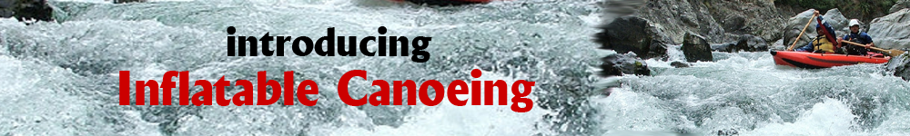
The most popular rivers (river means ‘Sungai’ in Malay) to canoe in Malaysia are:
1. Padas River, 170km from Kota Kinabalu, Sabah, East Malaysia: See
www.impression.com.my/sabah/kk/padas/padas.htm and www.sabahtravelguide.com/mapguide/default.asp?page=padas.
2. Selangor River, near Kuala Lumpur West Malaysia: There is a challenging 2hour run on this river, especially during the rainy season, with rapids ranging from Class I to Class V. See river info
http://impressions.com.my/Raft/raft_sel.htm.
3. Kiulu River in Sabah, East Malaysia: See http://www.impression.com.my/sabah/kk/kiulu/kiulu.htm
4. Kampar River, Perak State, Malay Peninsula: See
http://impressions.com.my/Raft/itek/itek.htm.
5. Sungai Itek River, Perak State, Malay Peninsula: See
http://impressions.com.my/Raft/itek/itek.htm.
6. Sungkai River, Perak State, Malay Peninsula: This river is better suited to kayaking.
7. Jeram Besu, Pahang State, Malay Peninsula: See
http://impressions.com.my/Raft/raft_JB.htm.
8. Telom River, Pahang State, Malay Peninsula: See
http://impressions.com.my/Raft/telom/telom_rafting.htm.
9. Kuala Perahu River, Pahang State, Malay Peninsula: See
http://impressions.com.my/Raft/telom/k_perahu/k_perahu.htm
10. Loh River, Trengganu State, Malay Peninsula: See
http://impressions.com.my/Raft/loh/loh_main.htm.
11. Sedim River, Kedah State, Malay Peninsula: See
http://impressions.com.my/Raft/raft_sedim.htm.

There have been numerous deaths on Malaysian rivers as a result of poor tour guide practices. Then there was the drowning of a Dutch tourist on the Padas River in November and another fatality this Dec-07. The risks posed are:
1. Rafting companies taking too high risks because of the desire to maximize profits. The implication is that they might:
2. Run river tours after heavy rains and no assessment of any damages that have since developed
3. Fail to practice safe procedures to safe time
4. Rafting company staff not having the experience to assess the risk due to inadequate training or lack of safety procedure adherence
5. If you want professionals I would go with river companies with experienced raft guides and the kayak rescuers on standby. The risk posed are adventurers getting trapped in holes, snagged by branches, trapped under the raft, though the buoyancy and headgear should otherwise prevent drowning and head injuries, assuming the gear is worn correctly. Choosing a responsible and safety-conscious operator is the key to avoiding mishaps. When rafting it does not help that 90% of any 13-party group are likely to be “virgins” to whitewater rafting.

Questions you can ask an operator before signing up for a rafting trip:
1. What grade is the river? Is it suitable for beginners?
2. What is your company’s safety track record like and what are the safety-and-emergency procedures?
3. Are your guides trained in Swiftwater Rescue and equipped with CPR and First Aid skills?
4. What kind of gear do you use and provide for participants (e.g. raft, helmet, PFD)?
5. Do you include insurance cover? Can this be arranged for us? Some companies like Pan-Global provide extensive coverage on outdoor sports
6. What is included in the cost?
7. What kind of clothing and things should one bring?
8. Do you have any referrals or testimonials from past participants?

Ensure the following:
1. You should be informed about the risks of rivers
2. The nature of rivers an how to pick features or characteristics
3. How to wear and use the safety equipment
4. How to paddle correctly – so you get good strokes and don’t hit your fellow paddlers with the oar.
5. What river guide instructions to listen to
6. Your guide should take you through some practice sessions on the river
7. How to stay in the raft when riding tough rapids
8. What you should do if you fall out or are thrown out of the raft, eg. Atch out for a throw bag (ie. a nylon sack).
9. They should be using good equipment
If you think you are going to be an experienced rafter after a trip – Think about. You are a fee-paying slave under instruction, getting the benefit of an adrenaline rush. Kayaking and canoeing offer you greater opportunity to develop independent judgement.

There are many rafting operators in Malaysia running the various rivers, though some have a dubious track record on the rivers and unsafe operating procedures. The operators with the best reputation are:
1. Tracks Adventures, a Selangor-based rafting outfitter in Kuala Kubu Baru. Tracks Adventures’ guides are all trained in Swiftwater Rescue, a course that teaches proactive prevention of river accidents and injuries certified by the New Zealand Canoeing Association. Guides learn to recognise and avoid common river hazards like “holes” that can trap and hold a buoyant object, and strainers (usually partly submerged trunks or logs) that can trap a swimmer underneath with the force of the current will hold him there. They practise self-rescue and methods of rescuing swimmers and recovering rafts and gear based on the American Canoe Association’s (ACA) syllabus (
www.americancanoe.org). Tracks Adventures has been running Selangor River since 1994. Tel: (60-3) 6065 1767; email: tracks@tm.net.my and www.tracksadventures.com.my.
2. Khersonese Expeditions: They are another experienced operator. Tel: (03) 7722 3511; Email:
info@thepaddlerz.com and www.thepaddlerz.com.
3. Riverbug: They are a Kota Kinabalu-based operator who has been in the business for 10 years. The company operates on Padas and Kiulu Rivers in Sabah, and Sg Kampar in Perak, and has offices in Perak and Kuala Lumpur. Their trainees have to run Grade I and II rivers at least 60 times, and grade III and IV 80 times before they are allowed to guide clients. Riverbug also uses safety kayakers on their runs. Tel: (60-3) 2162 0114 or
www.traversetours.com.

Many beginners are unaware of the dangers presented by rivers. Whitewater has swift and strong undercurrents. Listen to your guides safety tips carefully, follow their instructions, and exercise care. If you are risk-averse, don’t be lulled into going rafting. Avoid groups that take more than 3 rafts (30 to 40 clients) at a time, and those without rescuers in kayaks. Most accidents occur because clients don’t listen to instructions or they don’t take safety precautions seriously.

Friday, November 16, 2007

Canoeing the Murrumbidgee River, NSW, Australia

The Murrumbidgee River is one of the best rivers to canoe in Australia because you cam always expect a reliable flow of water since its feed by the Snowy Mountains HydroElectric Scheme, and because the waters held back by the reservoir system are slowly released over summer when most people want to engage in canoeing. Because of the artificial flow regime and the high demand for those water resources downstream, during summer the river has high discharge rates and corresponding fast water movement. I remember canoeing a section from Tharwa (just south of Canberra) to Red Rock Gorge, and the river narrowed from 20m wide to 8m, and passing through the shoot was like being in a washing machine, being thrown from one rock to another. The consequence was a hole in the canoe.

This section of rive made for a good run for the later reasons, though this was a period of high water level, so more information would be warranted on river conditions. At the time I remember the water level was flowing well over the ford.

Thursday, November 15, 2007

Barrington River Trip, Newcastle NSW Australia

The Barrington River is one of the best rivers to canoe in Australia. The appeal lies in its:
1. Proximity to Sydney
2. Its reliable water supply
3. Preservation of its natural bushland

Australia has been undergoing a climatic shift for the last 50 years - nothing new in that - despite the rhetoric that the planet is being destroyed. In fact the Earth's climate has been since the planet was formed. Anyway, the east coast of Australia is drier, the Carpenaria area is wetter. The bad news is that the rivers in NSW are not as wet as they once were, and amidst a drought, things are even worse. So if you intend to canoe, you need to make sure there is adequate water in the rivers. The good news is that the various water authorities in Australia now keep water level height and rainfall information in online databases, so you can readily see what is a good water height, and when to go. Website??

You can access the Barrington River by driving from Sydney, up the Pacific Highway. After Raymond Terrace take the left turn on the Bucketts Way to Gloucester. When you reach Gloucester continue through the town on the Scone road. You will eventually reach the town of Barrington, and soon after you will encounter the Barrington River. If you are doing the upper section, you will need to continue on past Copeland to the river junction. There is camping and good horse riding on a farm nearby. If you are canoeing from Rocky Crossing you can take the left turn off before or after the river, since they both follow the river, but the west-side option allows you to finish at the Barrington Bridge, whereas the east-side option lets you finish at either place. There is also camping at Barrington Bridge, though facilities are limited.

The Barrington River drains off a volcanic rangeland called Barrington Tops. The 'Tops' are snow covered at times in winter, and a number of peat bogs on the plateau ensure a regular release of water at times when other rivers are dry. The river flows through state forest and farmland, though these days its mostly unproductive hobby farms that dominate.

There are a number of river entry points:
1. Junction of the 2 rivers west of Copeland
2. Rocky Crossing
3. Canoelands
4. Barrington Bridge

Since I normally go with people that dont have a canoe, and have no experience, I usually take the section from Rocky Crossing to Canoelands. Its about a half day trip. I did the section to Barrington Bridge, but unfortunately the pace was slow because he had no sense of balance, even with my old 'flat floater'.

This river is mostly grade 2, with a few grade 3 rapids. They can be technically difficult if the water levels are higher. Alternatively you could be dragging the canoes if the water levels are low. To much sun is not a problem since the river is mostly lined by trees. There are a few snags, but it is mostly rocky, so wear a helmet for head protection. Also where a life jacket as there are traps. The biggest concern I think is water flowing under overhanging cliffs, where the river in undercutting old stream bed. The river flow is not as strong in low water so that should not be a problem if you anticipate and practice canoe control in the upper section.

The upper section requires a long day to complete. It requires a fair amount of rain to navigate. It has a steeper gradient so the river is narrow and fast-flowing. Its not as technically difficult, but there are low branches. Some people do the lower section first as its slower water. There are few egress options on the upper section if you have problems, so in a way its suits the disposability of an inflatable canoe, but who wants to abandon a canoe on the river if they get a hole. I have never patched up a canoe on the river, so I'm not sure how quickly they dry/repair. Maybe in the sun not so long. Anyway after 10 trips, I've only had 1 puncture for a $200-250 canoe. Thats pretty cheap travelling. And I think the offending object was glass or steel (in Japan) looking at the sharpness of the cut.

Anyone want to take a run on this river let me know.

Saturday, February 18, 2006

River Canoeing / Kayaking in Japan

Anyone up for some adventure in Japan? Japan is not exactly recognised for its wild rivers or challenging rapids, in fact the country is better known for its industry and rather tame rivers. But this is truly deceptive because the country hosts some incredibly beautiful mountain forests, wild scenic rivers and great canoeing - contrary to western perceptions. A few facts:

  1. Japanese rivers are mostly regulated by reservoirs, so they offer very consistent discharge during Spring to Summer. The opposite of course is true in winter. Unregulated rivers differ, though who wants to canoe in snowmelt - not me. But there is is alot of water in this country as rainfall is very reliable. Waterworks are intended more for flood prevention and water supplies.
  2. Alot of rivers have alot of waterworks, eg. concrete walls, weirs and levee banks, but there are still alot of rivers which are essentially untouched, and close to Tokyo and Nagano international airports as well. Some of these waterworks make the rivers more dangerous to canoeists. eg. There are dangerous weirs that provide no warning of danger, there are cement works that have been poorly rendered, leaving steel wire sticking out. Apart from puncturing an inflatable canoe, it might just rip your bowels out.
  3. Japanese rivers originate in tight mountain valleys, with little human impact, so with regular discharge, the rivers are very clean. They are mostly surrounded by forest, sometimes farmland. They are visually most appealing in early April (Cherry Blossum season 1-2weeks) and Autumn fall (Oct).
  4. Like other developed countries, Japan offers water discharge statistics on river authority databases, so its easy to get an idea of water level.
  5. Japan has the best rail transport system in the world, so its likely that you can get to the top of some river by train. Anyway, at least close, and you are sure to have a bus service to take you up the river and to pick you up.

My advice is to join one of the adventure companies based out of Nagatoro (Saitama Prefecture) or Outdoor Adventures (Murakami, Gumna Prefecture), or bring with you an inflatable canoe. I used to lug around a fixed kayak before I discovered the benefits of inflatables. Most of the rivers are shallow braided gravel races, grading 1-2, but the water is really clean in the upper reaches, with good flow, very consistent grades, and beautiful countryside. Access is easy with a Japan Rail Pass. The places to canoe include:

  1. Tamagawa River - Okutama Dam to Ome township, west of Tokyo. Use JR Chuo rail line
  2. Murakami River around Murakami, Gumna Prefecture, NNW of Tokyo - it has adventure companies running rafting. See Outdoor Adventures (??) www.canyon.ne.jp??
  3. There is a river east of Morioka in Iwate Prefecture, Northern Honshu for canoeing. If you need equipment, I'm not sure whats available.
  4. Rafting on a river between Nagano & Matsumoto in Nagano Prefecture, West of Tokyo. Its a great hiking area as well.

English-speaking staff at the shinkansen (very fast train) station tourist offices in Nagano and Morioka can give any tourist & canoeing information, so they can direct you how to book, get to the river, etc when you arrive.

Enjoy!