Inflatable Canoeing Adventures - Buy this eBook!

Most of us can relate to the fun we had canoeing at summer camp when we were young. But that was nothing compared to the experience of whitewater kayaking that came next for me. I have always loved canoeing, though it always seemed difficult to participate. It has only been in the last decade that the development of inflatable canoes has made a big difference. You can more easily access rivers, you can store a canoe in your car, you can even take them on a plane. They are very light, very cheap, with little loss of functionality. Perfect for weekends away or campervan holidays. Social networking was the other big change. You can now use Facebook, etc to join canoeing adventures in your local region or abroad.

Inflatable Canoeing Adventures - view the table of contents! Click here to download the table of contents for this eBook, available for just $US7.95.
Showing posts with label Philippines. Show all posts

Tuesday, July 21, 2009

Kayaking the Chico River

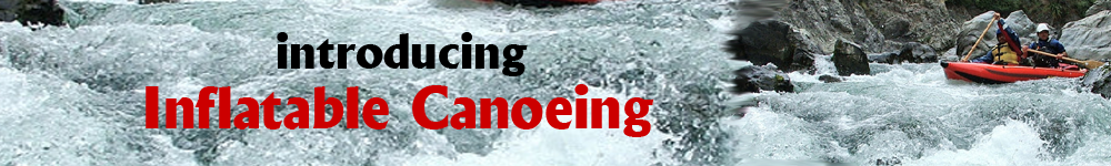
Last week we visited the area of Sagada, which hosts some of the Philippines best limestone caves. Actually I did not visit the caves, as I was quite sure they would not be as spectacular as Jenolan Caves, west of Sydney. Anyway, 10km south of Sagada is the town of Sabangan, which lies on the Chico River. The Chico River would have to be one of the better rivers in the Philippines for kayaking. The river has a continuous series of rapidsore interested in the canoeing, so for those who are similarly interested, I am planning a return to the area in May 2010 to kayak this river. The rapids are mostly grade 2-3. I hear there are grade 4-5 rapids, though based on my river observation from the main road, this is more likely the lower section. I only saw the river as far as east as the Sagada turn-off, and it was not suited to rafting (i.e. too narrow, too shallow). The Chico River flows from Mountain Province, a few hundred kilometres north of Manila, but it takes 6 hours alone to drive the 80km section from Baguio-Sagada because although the road is mostly sealed, its VERY windy. Fortunately there were no tricycles in this section.

I would also be worthwhile to take some time to walk along the river from Panorama ParkView to the town of Sabangan. I have no doubt that you should be able to get a tricycle back to your car if you leave your car there, otherwise its a steep walk back to the car. There appears to be a steep alternative exit further back (round trip). I did not do it on this walk, but I would like to return to the area to kayak the river and to walk along the Chico River. The pathway passes along the river through rice terraces.
Increasingly I see that the Dept of Tourism in the Philippines is starting to spend money on worthwhile project as these to boost tourism, and to give visitors something to do. If you are more interested in rafting, there are groups that run rafting trips on the river. I have information on this, or you can inquire at the Rock Inn, in Sagada. This is a fairly nice place to stay. Nice accommodation, though off-season you will have to wait a few hours for a meal as they do down to the markets to buy the food.
If you want to get to this area, I would advice coming in from the Nueva Viscaya province (east side). The road is not as good, but it will be faster, particularly as they are currently upgrading the road - sealing it with concrete. Baguio is a great market to buy food, and there are some good entertainment places there. Many foreigners like living there because its cheaper, cooler, though it is congested because of the mountain topography.
----------------------------------------------
Andrew Sheldon www.sheldonthinks.com

Friday, January 02, 2009

Rafting the Chico River, Cagayan Province, The Philippines

The Chico River flows east to Tabuk City, before joining the Cagayan River 40km to the north. Tabuk City is easily reached by bus from Tuguegarao City, which provides a flight connection to Manila (PR208). Alternatively you can travel on the Haisema Mountain Highway from Baguio City or the Mountain Polis Highway from Manila. From Tabuk City you can get a jeepney west to Pasil in Kalinga municipality.
There is a 4 hour rafting adventure offered on the Chico River between Pasil and the exit point at Tabuk. The trip covers beautiful scenery such as gorges and waterfalls. The rapids on the Chico River are rated as Grade 2 to 4. After the trip, you can easy get a meal in Tabuk City, and commute back to Tuguegarao City for a flight to Manila (PR237).
Marsman Drysdale Travel Inc organizes rafting adventures on the Chico River from their head office at: 19th Floor Robinsons Summit Center 6783 Ayala Avenue, Makati City, Philippines or visit their website www.marsman-tours.com.ph
. Email: inquiry@marsmandrysdale.com. Telephone: (63-2) 887 0000.

Location Map References for Chico River: See http://maps.google.ca/maps?f=q&hl=en&geocode=&time=&date=&ttype=&q=chico+River+Philippines&sll=15.029686,119.20166&sspn=10.236578,20.43457&ie=UTF8&ll=17.39389,121.294556&spn=0.158242,0.31929&t=h&z=12&om=1
Info about Tabuk City – see http://en.wikipedia.org/wiki/Tabuk_City%2C_Kalinga
-----------------------------------------------
Andrew Sheldon www.sheldonthinks.com

Monday, January 14, 2008

Canoeing the Magat River, Nueva Viscaya, The Philippines

The Magat River flows north of Santa Fe town, in Nueva Viscaya, in Central Luzon. The section of river suitable for canoeing is marked on My Google Maps at http://maps.google.com.au/maps/ms?hl=en&ie=UTF8&msa=0&msid=106791913239054408744.000443a6386cb1a223c36&ll=16.272028,121.03157&spn=0.319682,0.63858&t=h&z=11&om=1.
This river is well suited for novice canoeing. The water is Grade 1 to 2. The river offers only a short trip as the river quickly broadens out on the valley floor, and as the river disperses, the water becomes flat. Despite this the area is very scenic. At Aritao, the river is flat. The roads in this area are very straight and not so busy, though I performed my river survey on Sunday. Trucks and a multitude of tricycles are the biggest obstacle.


Canoeing at San Jose City, Nueva Eclija, The Philippines

The San Jose River is easily accessed from Manila by bus – it takes about 6 hours. Access to the river is easily achieved along the highway heading north, whether by car, bus or jeepney. The following map will help you plan your trip – see www.mapplanet.com/?do=map&id=4900470&lat=15.8600&lon=120.3847. Better still use the Canoe Trip Map 1 I have constructed at http://maps.google.com.au/maps/ms?hl=en&ie=UTF8&msa=0&msid=106791913239054408744.000443a6386cb1a223c36&ll=15.918413,120.976639&spn=0.320252,0.63858&t=h&z=11&om=1
The river is grade 1-2 gravel races, so its well suited to beginners, though it might be advisable to undertake the trip when there is more water in the river (ie. After rain) so you don’t spend too much time on gravel. According to my trip notes, and my limited observation of this river, the section marked is navigable and offers some water flow and the possibility of rapids. Some rapids are evidence from the Mahalika Highway, though these are mostly gravel races suitable for beginners and children. Above a marked river confluence there is too little water, and below the Cowboy Grill (exit point on the highway), the river is flat, and thus boring for all concerned.

Sunday, January 13, 2008

Canoeing the Ibulao River, Banaue Area, Philippines

Every holiday I go on I am always looking for opportunities to go mountain biking or canoeing. Since canoeing is not very popular in the Philippines, I tend instead to look for rafting opportunities. Actually I heard of rafting in Ifugao Province whilst staying at the Banaue Hotel in Banaue, Ifugao Province. I had actually passed the river during the night getting to Banaue, so I was pleased to know I would see it returning to Manila. The Ibulao River rises in the mountainous regions of Ifugao Province.

There are several sections that offer whitewater:
1. Mungayang to Ibulao Bridge: This section of river is popular for rafting. The following map shows the location of Mungayang – on the Mountain Polis Highway – see www.mapplanet.com/?do=map&id=4880970&lat=16.2364&lon=121.1442, though I am not aware of the entry point. The exit point from the river is the Ibulao Bridge – viewed at: http://maps.google.com.au/maps?f=q&hl=en&geocode=&time=&date=&ttype=&q=lamut+philippines&sll=15.9761,120.5711&sspn=0.009964,0.019956&ie=UTF8&ll=16.784019,121.121049&spn=0.004961,0.009978&t=h&z=17&om=1.It&time=&date=&ttype=&q=lamut+philippines&sll=15.9761,120.5711&sspn=0.009964,0.019956&ie=UTF8&ll=16.784019,121.121049&spn=0.004961,0.009978&t=h&z=17&om=1.It might be best to ask locals how to get access to the river from the Mountain Polis Highway, or call the Adventure company below. I am guessing the rapids are grade 1-3 in difficulty.
2. Ibulao Bridge to Lamut (??): The possibility or utility of canoeing this section is unknown. I personally checked out the rapids in the gorge below Ibulao Bridge from a track running along the northern side of the gorge – follow the sign to the caves. Apart from providing a view of the river, I have seen a overloaded jeepney go along this road, so it must continue for some time. It might even provide an access point to the lower section of river. It would however be preferable to access the lower section of river from the highway around Lamut as the Caves road is mostly one-way with few turning places. There is a log in the gorge that would obstruct rafts from passing, and the conditions would make portage difficult. The obstruction should not hinder canoes however if they take the central route with care. Eventually this river joins a larger river before flowing into a reservoir (dam), so an exit around the confluence (flowing north) would be preferred, if not earlier. The rapids in the gorge are grade 1-3.

See my Ibulao Canoe Trip 3 - marked on my Google Maps at
http://maps.google.com.au/maps/ms?hl=en&ie=UTF8&msa=0&msid=106791913239054408744.000443a6386cb1a223c36&ll=16.680924,121.224518&spn=0.638012,1.277161&t=h&z=10&om=1hl=en&ie=UTF8&msa=0&msid=106791913239054408744.000443a6386cb1a223c36&ll=16.680924,121.224518&spn=0.638012,1.277161&t=h&z=10&om=1.


Accommodation is available in Banaue (The Banaue Hotel for P2300-3300/night) or Youth Hostel for P250/night) or perhaps Bagabag in the Cagayan Valley. See the following websites for video-photo footage of the river from people who have rafted this river with Uerm81 Adventures (email: totokalug@yahoo.com, Cell: 0919 694 5964) - see www.dailymotion.com/video/x1f4tf_river-wild and http://nl.truveo.com/Attandi-cudog/id/2769409785, and heaps of photos at www.flickr.com/photos/ral_m/page29. If you are concerned about leaving your vehicle around and like the idea of using inflatables, consider public transport options. Public transport necessitates travelling with an outdoors adventure company or using inflatable boats.
The options for transport include:
1. Bus from Manila – transfer in Cabanatuan City or Bagabag. Jeeyney to Banaue, and exit near river.
2. Bus from Manila – transfer in Baguio to Banaue jeepney.

Whitewater tubing the Sibulan River, Davao del Sur, Philippines

I have no paticular interest in 'tubing' but here is a blog by a guy who seems to get around more than me. See www.ivanhenares.com/2006/09/whitewater-tubing-in-davao-del-sur.html. This blog posting describes his whitewater tubing adventures on the Sibulan River in Barangay Santa Cruz, in the southern (Mindanao) province of Davao del Sur, close to the boundary of Davao City.

Sunday, December 30, 2007

Canoeing on the Pinacanauan River, NE Luzon, The Philippines

The Pinacanauan River is located in Cagayan Province in NE Luzon, in the Philippines. The city of Tuguegarao lies at the confluence of the Pinacanauan River and the much more significant Cagayan River. The best way to reach the Pinacanauan River is by road (Mountain Polis Highway) from Manila or flight PR208 from Manila to Tuguegarao. Upon arriving at Tuguegarao, take a jeepney destined for PeƱablanca, and continue further upstream. If you refer to the map reference for Callao Caves below, you will see that there is a belt of limestone crossing the river. This formation hosts a multitude of caves, some of which you may access from the river. Search Google for more info on Callao Caves.
For accommodation, you can camp on the river or try staying at the Lorita Hotel in Tuguegarao.
Marsman Drysdale Travel Inc organizes kayaking trips on the river through their offices at: 19th Floor Robinsons Summit Center 6783 Ayala Avenue, Makati City, Philippines or visit their website
www.marsman-tours.com.ph. Email: inquiry@marsmandrysdale.com. Telephone: (63-2) 887-0000 (Trunkline). In fact that run a 4 day/3 night Northern Luzon Wilderness adventure tour involving caving, rappelling, kayaking and whitewater rafting.
The Pinacanauan River offers grade 1 to 2 rapids suitable for kayakers.


Location Map References
1. Google Maps – Try searching for “Pinacanauan River Philippines” at
http://maps.google.ca/maps?hl=en&tab=wl
2. Callao Caves – See
http://maps.google.ca/maps?f=q&hl=en&geocode=&time=&date=&ttype=&q=Pinacanauan+River&sll=3.951941,117.158203&sspn=41.419891,81.738281&ie=UTF8&ll=17.70323,121.822414&spn=0.078986,0.159645&t=h&z=13&om=1
3. Info about Tuguegarao: See http://en.wikipedia.org/wiki/Tuguegarao_City

Canoeing on the Pagsanjan River, Laguna, Philippines

The Pagsanjan River is located in the province of Laguna, Luzon in the Philippines. The river’s headwaters is the famed Mount Banahaw, from where is cascades through 3 gorges before reaching Lake Laguna. The river in fact provides 35% of the discharge into Laguna de Bay, despite being just one of the 21 major lake tributaries. For this reason the river is monitored by the Laguna Lake Development Authority(LLDA) at 15 river monitoring stations. The river is also referred to as the Pagsanjan-Lumban River after the towns of Lumban, Pagsanjan and Cavinti through which it flows. The river also hosts the popular the 100-metre high "Magdapio Falls" in the town of Cavinti, but also known as “Pagsanjan Falls”.
There are boat rides from Pagsanjan which run 16 rapids over a 17 kilometre section of the river, while passing through gorges and dropping several hundred feet before reaching the waterfall after the 14th rapid. The ride takes you through attractive natural bushland including orchids, ferns, vines, spiders, dragonflies, lizards and monkeys. The river grade I believe is 1-2, though I will not run it until I have a canoe shipped from China.


Map references
1. Township of Cavinti: See http://maps.google.ca/maps?f=q&hl=en&geocode=&time=&date=&ttype=&q=Cavinti+laguna&sll=14.268709,121.468449&sspn=0.040177,0.079823&ie=UTF8&ll=14.246498,121.506128&spn=0.040181,0.079823&t=h&z=14&om=1
2. Township of Pagsanjan: See http://maps.google.ca/maps?f=q&hl=en&geocode=&time=&date=&ttype=&q=Pagsanjan+laguna&sll=14.280936,121.505098&sspn=0.040175,0.079823&ie=UTF8&ll=14.268542,121.450768&spn=0.040177,0.079823&t=h&z=14&om=1

Photos
1. Photos of the Pagsanjan river: See www.panoramio.com/photo/515914

Canoeing the Bued River, Baguio City, Philippines

There are very few rivers in the Philippines suited to canoeing. I suspect the reason is the high permeability of the relatively recent volcanic ash covering the country. The implication is that surface water can flow in the high mountain gorges, but once they reach the alluvial flats, the river water quickly percolates into the alluvial flats leading only the sediment pile they carried. The Bued River flowing south west of Baguio City in central Luzon is a good example of this.
The only settlement of note along the river is Twin Peaks, though there are a number of old settlements that date back to the original construction of Kennon Road – numbering from Camp 1 in the south west to Camp 8 near Baguio. Kennon Road requires constant maintenance and several bridges have been upgraded, but the road is single carriage way along the length of the river, thus the 49km road takes 45mins to ride.
Upper Bued River Description
The Bued River Catchment is one of the most scenic in the Philippines. The precipitous drops from the 1600m high mountain tops to the valley floor have created some stunning scenery. The river between Baguio and Rosario has excellent road access given that the road follows the river. Yet in the upper section the drop to the valley floor is very steep. For this reason there are few opportunities to gauge the nature of the river - other than to say access is difficult in the upper section. There is however access, and the limited observation from the road suggests the river is for the most part too rocky to navigate at normal water.

At normal water levels the upper section (above the Twin Peaks Bridge) is not navigable because of the prevalence of boulders. There is however the possibility of navigating the river from several points upstream from Twin Peaks:
1. Highest: There is a bridge – so likely better access. See http://maps.google.com/?t=k&om=1&ie=UTF8&ll=16.2947,120.595508&spn=0.002487,0.004989&z=18
2. Intermediate: There appears to be a flying fox at http://maps.google.com/?t=k&om=1&ie=UTF8&ll=16.292054,120.592037&spn=0.002487,0.004989&z=18.
3. Lowest: There is a flying fox above Twin Peaks at http://maps.google.com/?t=k&om=1&ie=UTF8&ll=16.277677,120.568616&spn=0.002487,0.004989&z=18.
Observation during high water would be needed to establish the safety and suitability of the river under those conditions. The river gradient is steeper, so the possibility of treacherous rapids or falls is higher, and it is unknown whether any danger would be readily apparent. Notwithstanding the risk, there is an opportunity to start canoeing from the latter points. No grading of this section of river can be realistically be made.
Photo from the upper section - around Camp 4

Lower Bued River - Twin Peaks Bridge to Sison
Not having canoed this river – it does require a degree of caution. Though having observed the rivers character from the road it appears to have no treacherous rapids or falls below the Twin Peaks Bridge, however caution and experience is still advised. The river is narrow because of the V-shaped valley, and its strewn by rocks. At normal water the river grades 1-2, with the rock gardens tending to slow the river speed despite the moderate gradient in this section. Access is provided readily from the road, and local squatters tend not to mind the intrusion.

Photo of Boed River downstream from the Twin Peaks Bridge.
The Twin Peaks Bridge is located at http://maps.google.com/?t=k&om=1&ie=UTF8&ll=16.260199,120.556519&spn=0.002487,0.004989&z=18). From the Twin Peaks Bridge, at normal river height, the river appears to be navigable at least until the bridge at map reference http://maps.google.com/?t=k&om=1&ie=UTF8&ll=16.239393,120.521522&spn=0.002488,0.004989&z=18). There is another bridge further downstream at map reference http://maps.google.com/?t=k&om=1&ie=UTF8&ll=16.208179,120.509055&spn=0.002488,0.004989&z=18, however the river may have insufficient flow at this point. The lack of flow can be attributed to the rapid percolation of the river discharge into the permeable unconsolidated river ash that has coated the mountains in the catchment after the 1994 Mt Pinatubo eruption, and subsequently been dumped at the mouth of the valley as it enters the plain.

Baguio City Resources
The following resources might be helpful to you. The Bued River has a lot of history. The Kennon Road between Rosario and Baguio was built between 1903-05 by Japanese labour under the supervision of American engineers.
Ask questions at
http://www.baguiocity.com/bcmain_forum.php
Neighbouring Benguet Province – see www.benguet.gov.ph
History of Kennon Road
http://en.wikipedia.org/wiki/Kennon_Road
City office info
http://www.baguiocity.com/bcmain_ctprof.php Travel details - http://www.benguet.gov.ph/index.php?option=com_content&task=view&id=78&Itemid=159